Tunneling
Dahil sa kakaibang topograpiya ng lugar ng proyekto, na kinabibilangan ng matataas na disyerto na rehiyon ng Antelope Valley, matataas na kabundukan ng San Gabriel Mountain range at siksik na urban area ng San Fernando Valley, ang mga tunnel ay ginagamit sa buong seksyon ng proyekto. Ang mga tunnel na ito ay ginagamit upang matugunan ang mga hadlang sa topograpiko (matataas na bundok), at maiwasan at mabawasan ang mga epekto sa mga komunidad, tirahan at mga pasilidad sa itaas (mga tahanan, mga freeway, atbp.). Sa mga kumplikadong geological na kondisyon at fault zone sa loob ng mga tunneling area, ang mga pangunahing pagsasaalang-alang ay isinasaalang-alang sa mga elemento ng disenyo, tulad ng uri ng tunnel, seismic fault chamber, access point, sound mitigation at kaligtasan. Ang tinatayang haba ng mga tunnel sa Palmdale to Burbank Project Section ay 22 hanggang 28 milya.
Kasama sa Preferred Alternative, SR14A, ang apat na tunnel na may kabuuang 28 milya.
Mga Uri ng Tunnel


Tunnel Boring Machine Animation
Pagtatanghal ng Tunneling
Depth Maps
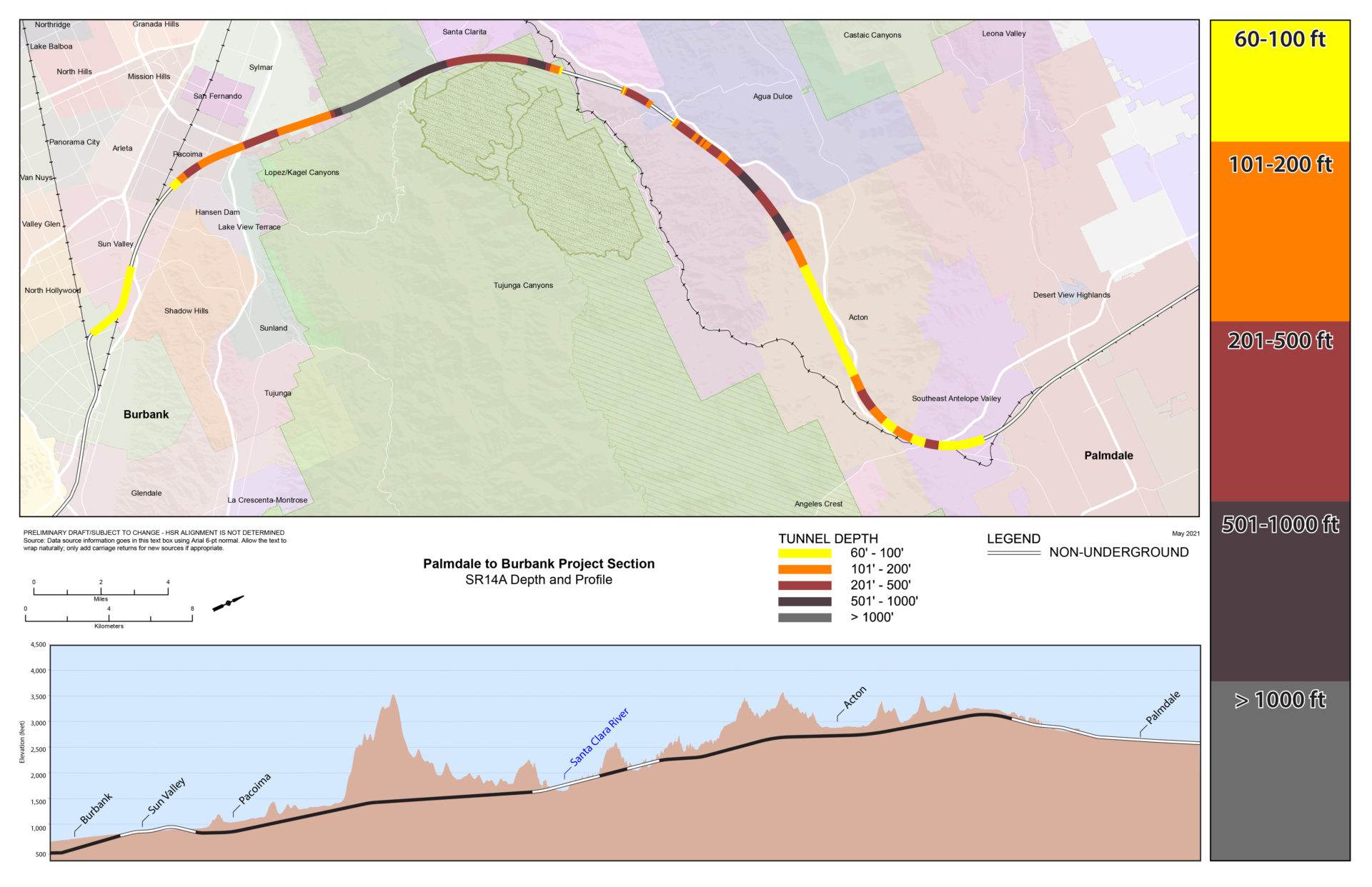
Tunnel Depth Map SR14A
(Pinugustuhang Alternatibo)
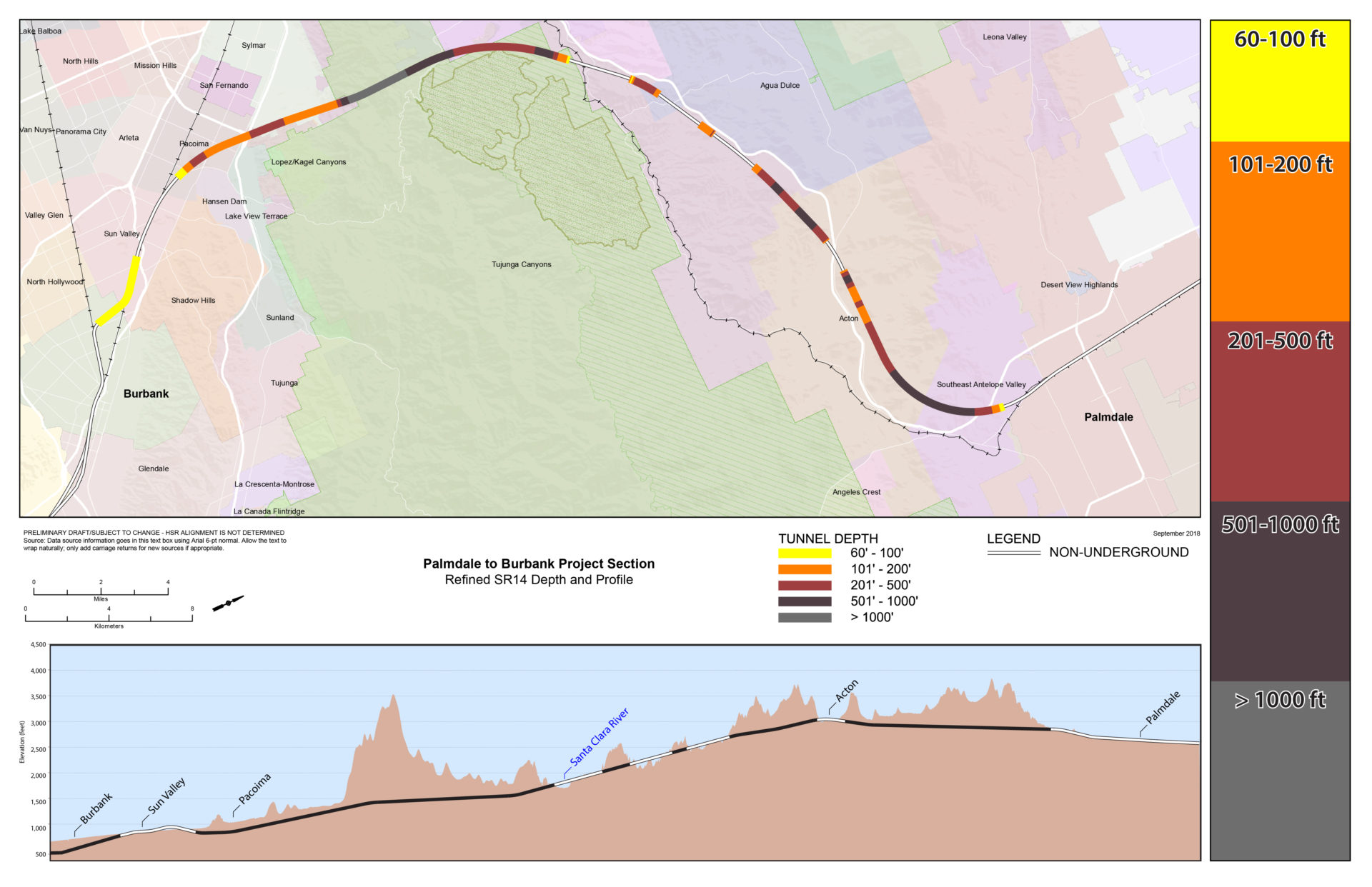
Tunnel Depth Map Pinong SR14
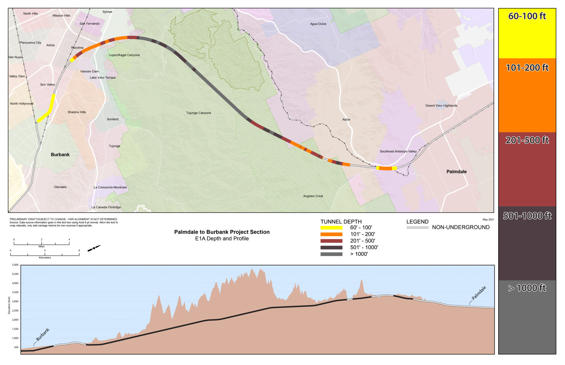
Mapa ng Lalim ng Tunnel E1A
Mapa sa Lalim ng Tunnel E1

Tunnel Depth Map E2A

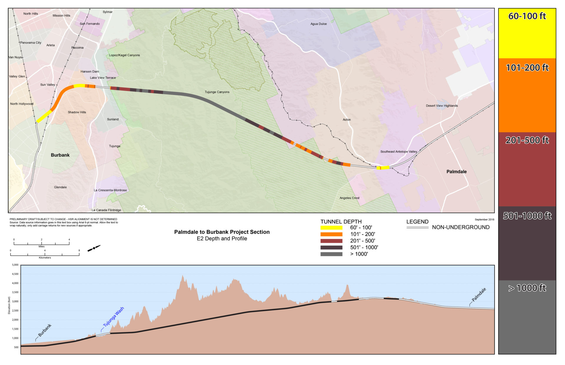
Mapa ng Lalim ng Tunnel E2
Paghahambing sa Pagitan ng mga Ruta
Ang talahanayang ito ay nagbibigay ng impormasyon tungkol sa bawat alternatibo mula sa Spruce Court sa Palmdale hanggang sa Burbank Station, kasama ang iba't ibang feature ng disenyo at haba ng segment ng tunnel.

Mga Halimbawa ng Portal

