Tunelización
Debido a la topografía única del área del proyecto, que incluye regiones desérticas altas del Valle Antílope, altas montañas de la cordillera de San Gabriel y densas áreas urbanas del Valle de San Fernando, se utilizan túneles en toda la sección del proyecto. Estos túneles se utilizan para abordar las limitaciones topográficas (altas montañas) y evitar y reducir los impactos en las comunidades, el hábitat y las instalaciones que se encuentran arriba (casas, autopistas, etc.). Debido a las complejas condiciones geológicas y las zonas de fallas dentro de las áreas de tunelaje, se tuvieron en cuenta consideraciones clave en los elementos de diseño, como el tipo de túnel, las cámaras de fallas sísmicas, los puntos de acceso, la mitigación del sonido y la seguridad. La longitud aproximada de los túneles en la sección del proyecto de Palmdale a Burbank es de 22 a 28 millas.
La Alternativa Preferida, SR14A, incluye cuatro túneles con un total de 28 millas.
Tipos de Túneles


Animación de la máquina perforadora de túneles
Presentación de Túneles
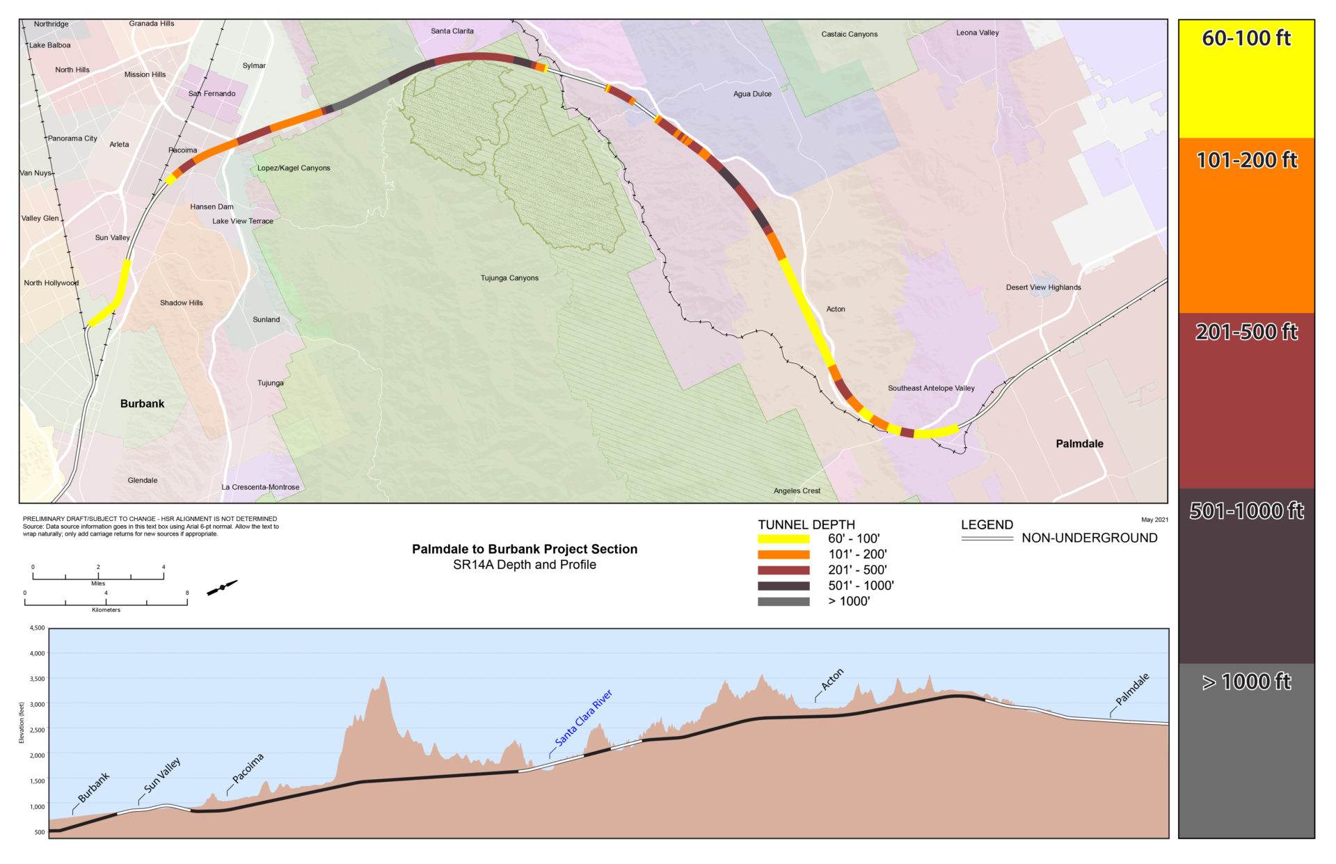
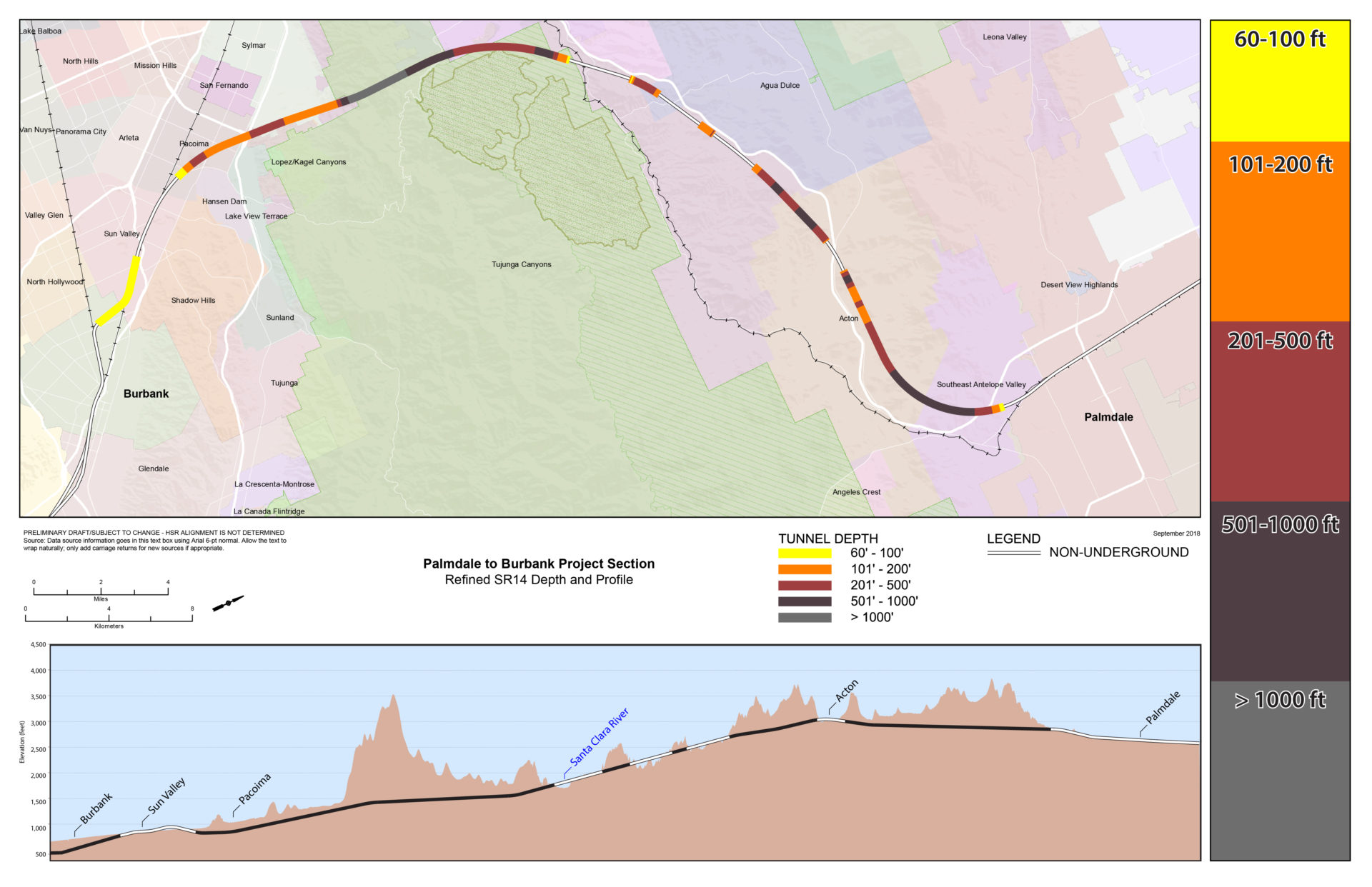
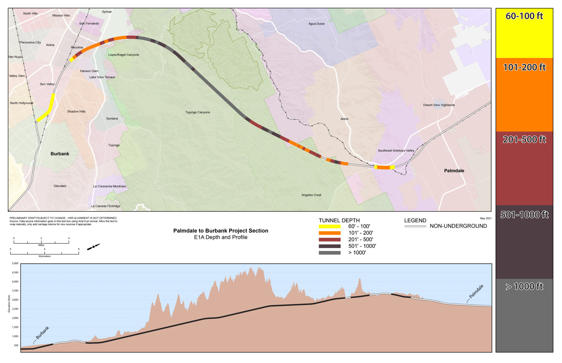
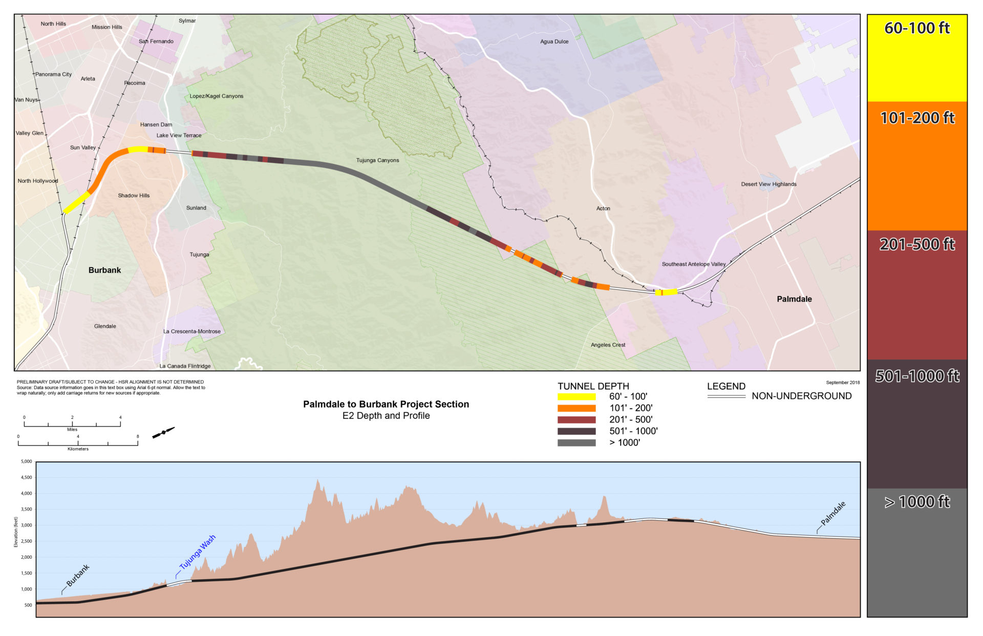
Mapas de profundidad
Mapa de profundidad del túnel SR14A
(Alternativa preferida)
Mapa de profundidad de túnel refinado SR14
Mapa de profundidad del túnelE1A
Mapa de profundidad del túnel E1

Mapa de profundidad del túnel E2A

Mapa de profundidad del túnel E2
Comparación entre rutas
Esta tabla brinda información sobre cada alternativa desde Spruce Court en Palmdale hasta Burbank Station, incluidas las diferentes características de diseño y las longitudes de los segmentos del túnel.

Ejemplos de portales

