隧道
由于项目区域地形独特,包括羚羊谷的高沙漠地区、圣盖博山脉的高山和圣费尔南多谷的密集城市地区,整个项目区段都使用隧道。这些隧道用于解决地形限制(高山),避免和减少对上方社区、栖息地和设施(住宅、高速公路等)的影响。由于隧道区域内地质条件和断层带复杂,设计元素考虑了关键因素,例如隧道类型、地震断层室、接入点、隔音措施和安全性。帕姆代尔至伯班克项目区段的隧道长度约为 22 至 28 英里。
首选替代方案 SR14A 包括四个总长 28 英里的隧道。
隧道类型


隧道掘进机动画
隧道演示
深度图
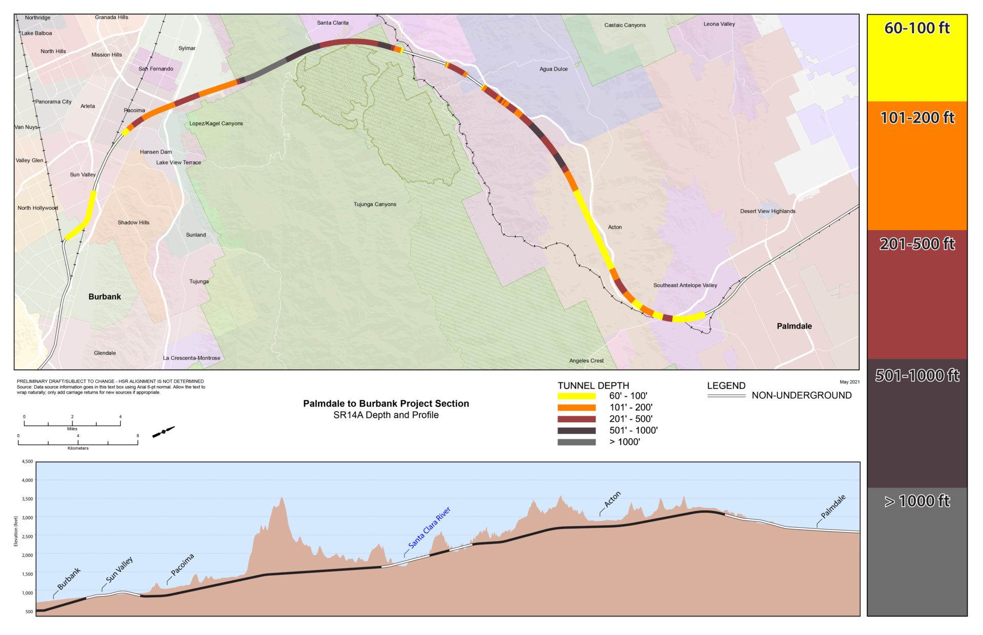
隧道深度图 SR14A
(首选替代方案)
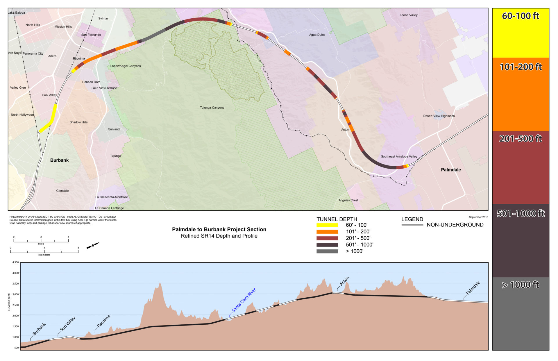
隧道深度图 SR14
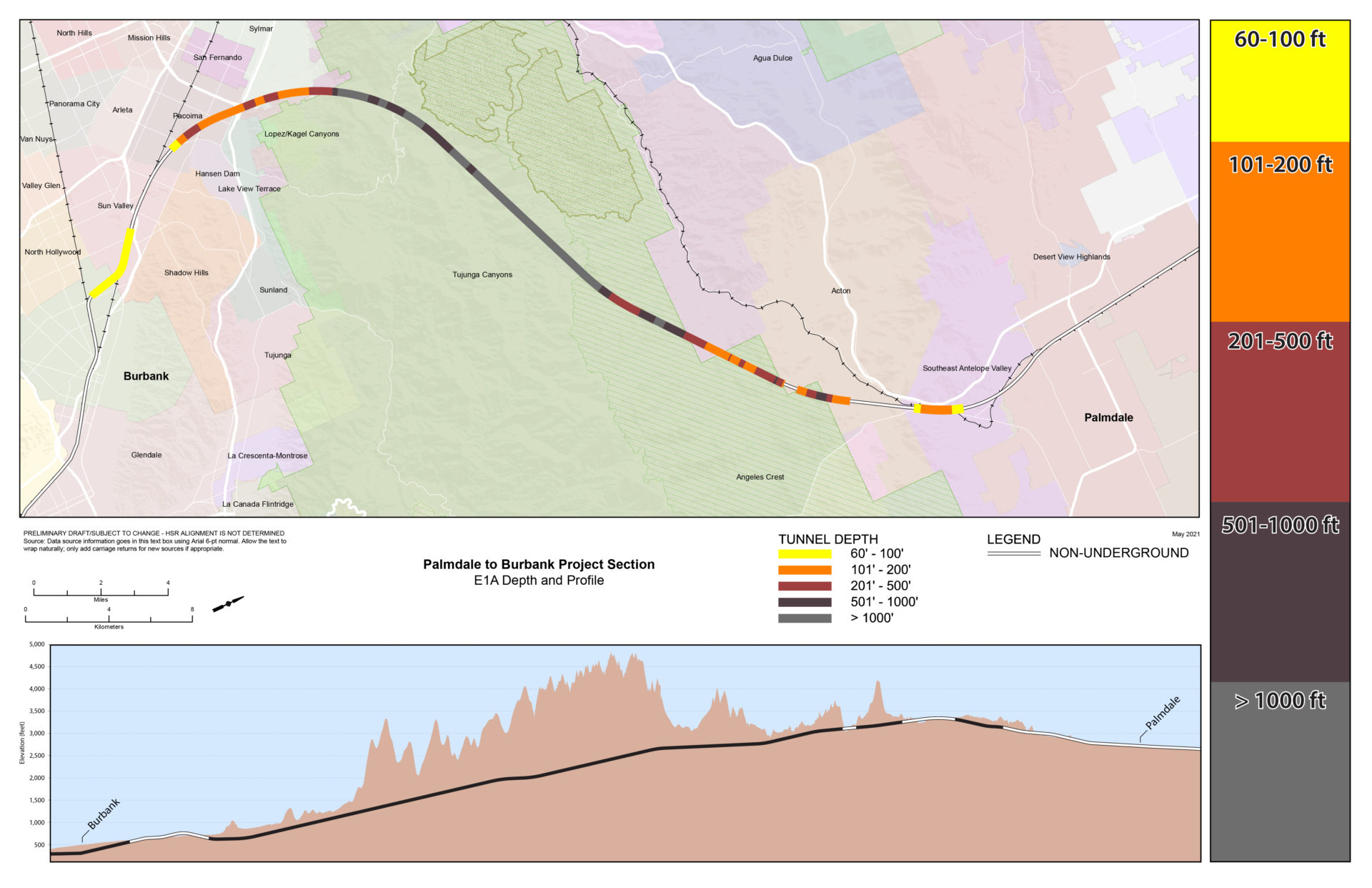
隧道深度图 E1A
隧道深度图 E1

隧道深度图 E2A

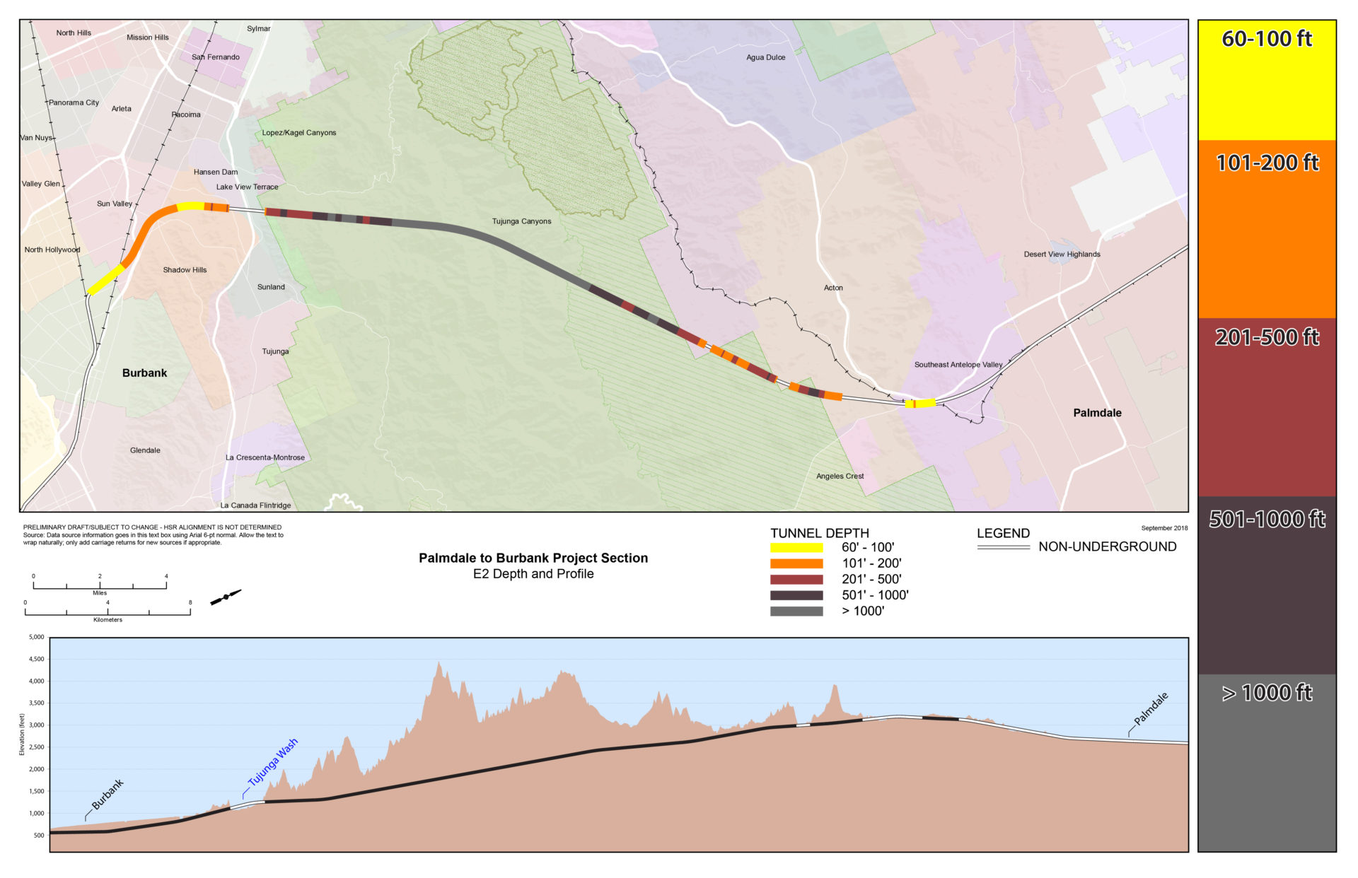
隧道深度图 E2
路线比较
此表提供了从 Palmdale 的 Spruce Court 到 Burbank 站的每个备选方案的信息,包括不同的设计特征和隧道段长度。

门户示例

