Tunneling
Due to the unique topography of the project area, which includes high desert regions of the Antelope Valley, high mountains of the San Gabriel Mountain range and dense urban areas of the San Fernando Valley, tunnels are utilized throughout the project section. These tunnels are used to address topographic constraints (high mountains), and avoid and reduce impacts to communities, habitat and facilities above (homes, freeways, etc.). With the complex geological conditions and fault zones within the tunneling areas, key considerations were accounted for in the design elements, such as type of tunnel, seismic fault chambers, access points, sound mitigation and safety. The approximate length of tunnels in the Palmdale to Burbank Project Section is 22 to 28 miles.
The Preferred Alternative, SR14A, includes four tunnels totaling 28 miles.
Types of Tunnels


Tunnel Boring Machine Animation
Tunneling Presentation
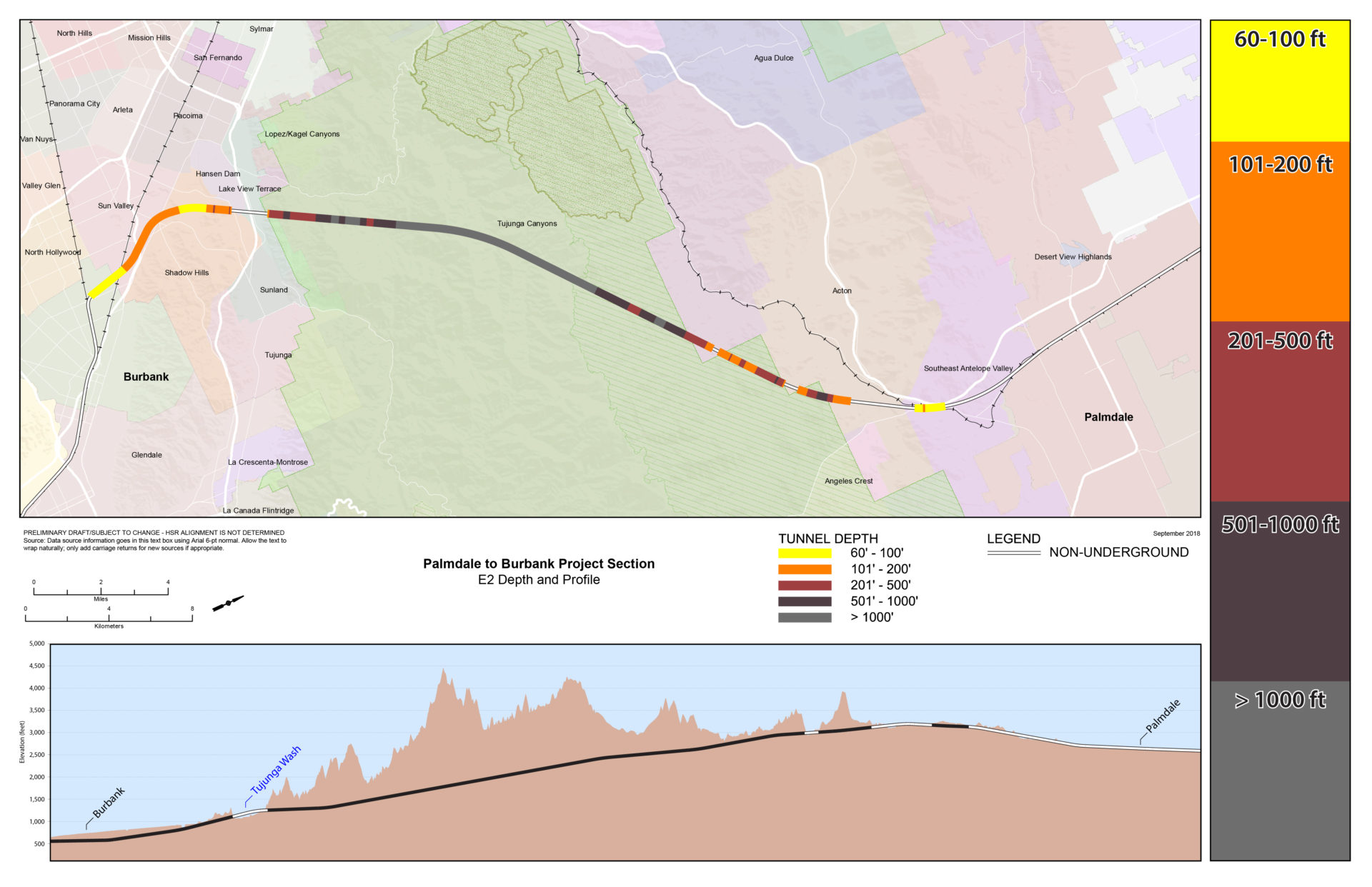
Depth Maps
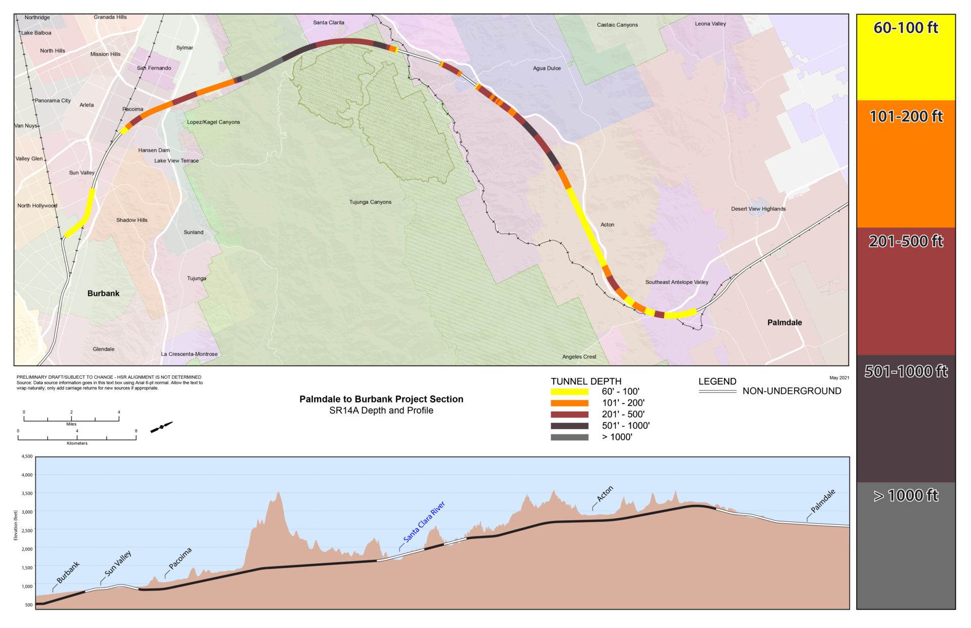
Tunnel Depth Map SR14A
(Preferred Alternative)
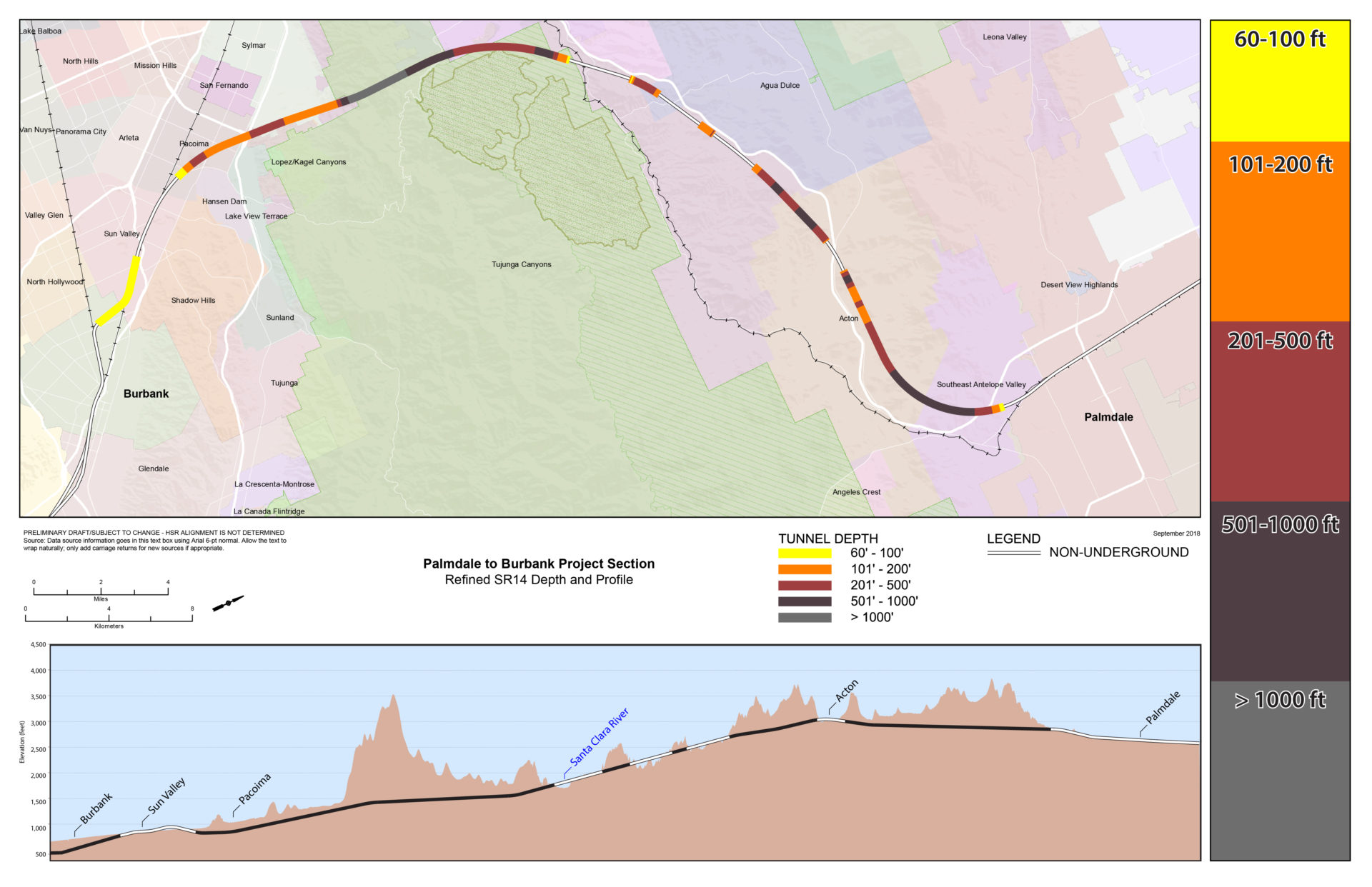
Tunnel Depth Map Refined SR14
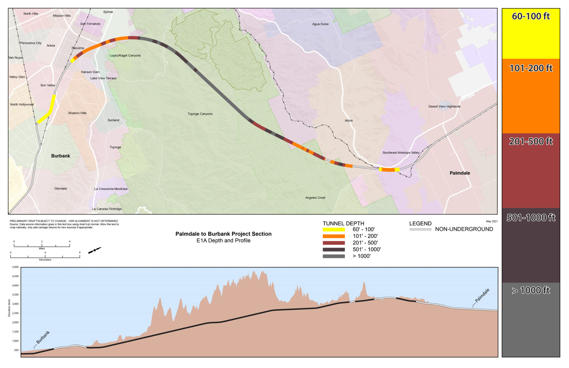
Tunnel Depth Map E1A
Tunnel Depth Map E1

Tunnel Depth Map E2A

Tunnel Depth Map E2
Comparison Between Routes
This table provides information about each alternative from Spruce Court in Palmdale to Burbank Station, including the different design feature and tunnel segment lengths.

Portal Examples

