トンネリング
プロジェクトエリアの地形はアンテロープバレーの高地砂漠地帯、サンガブリエル山脈の高山、サンフェルナンドバレーの密集した都市部など、独特なため、プロジェクトセクション全体でトンネルが利用されます。これらのトンネルは、地形上の制約 (高山) に対処し、コミュニティ、生息地、および上部の施設 (住宅、高速道路など) への影響を回避および軽減するために使用されます。トンネルエリア内の複雑な地質条件と断層帯を考慮して、トンネルの種類、地震断層室、アクセスポイント、騒音緩和、安全性など、設計要素で重要な考慮事項が考慮されました。パームデールからバーバンクまでのプロジェクトセクションのトンネルの長さは、およそ 22 ~ 28 マイルです。
推奨される代替案である SR14A には、合計 28 マイルの 4 つのトンネルが含まれています。
トンネルの種類


トンネル掘削機のアニメーション
トンネリング プレゼンテーション
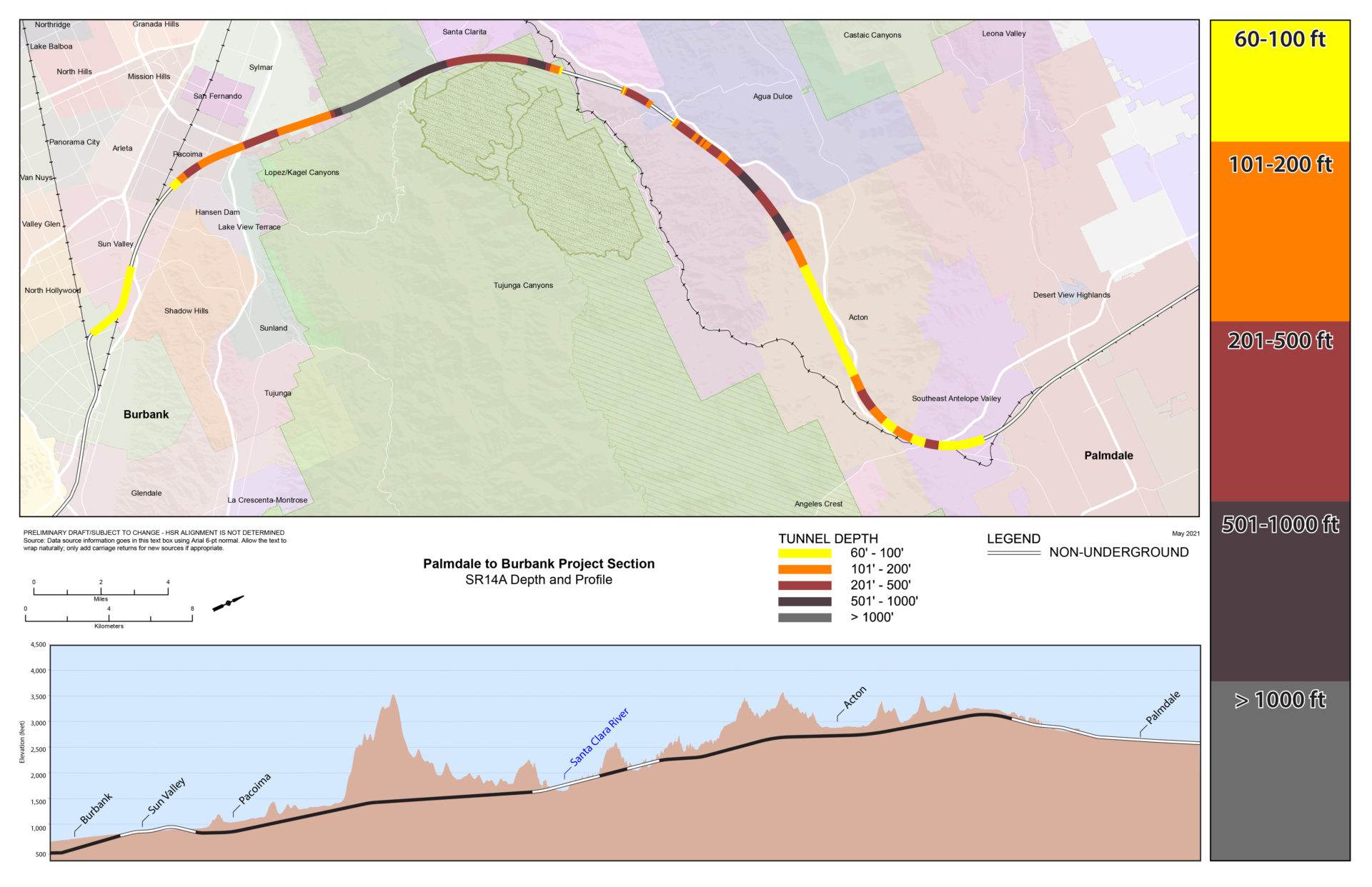
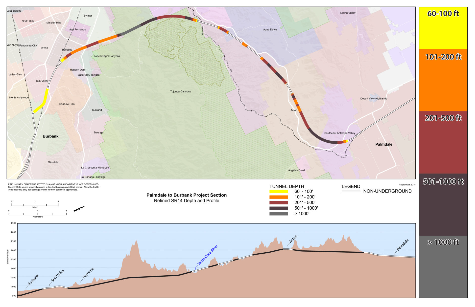
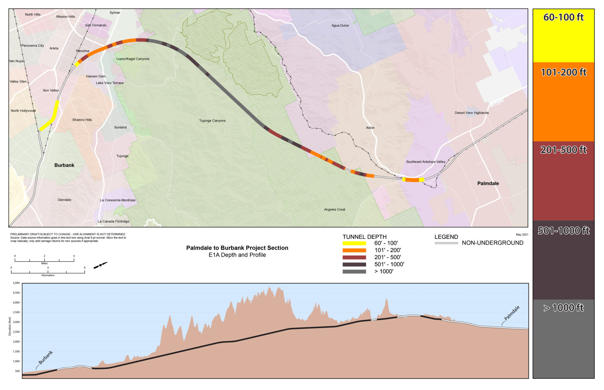
深度マップ
トンネル深度マップ SR14A
(推奨される代替手段)
SR14 の改良されたトンネル深度マップ
トンネル深度マップ E1A
トンネル深度マップ E1

トンネル深度マップ E2A

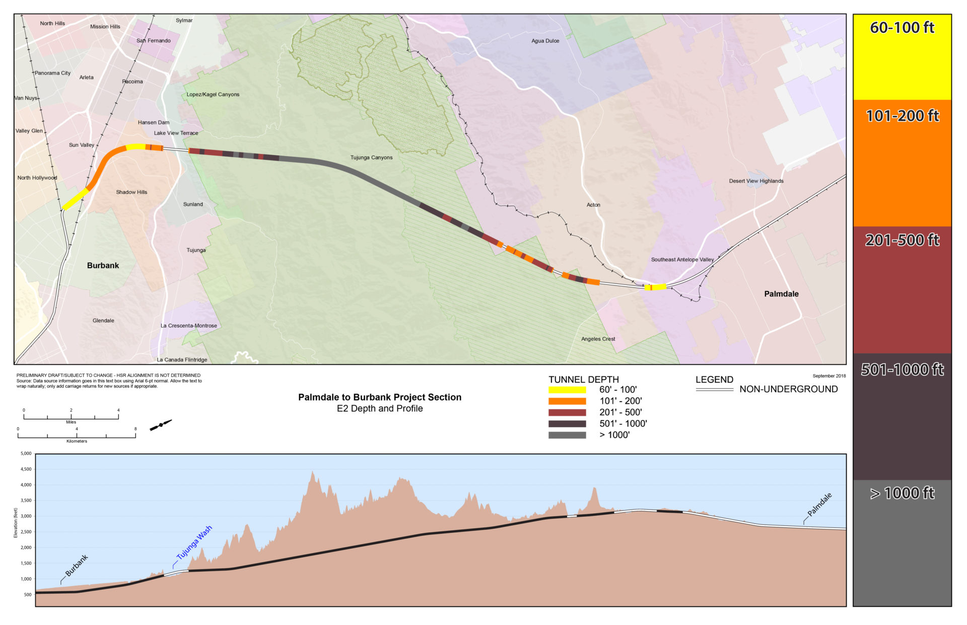
トンネル深度マップ E2
ルート間の比較
この表は、パームデールのスプルース コートからバーバンク駅までの各代替案に関する情報を提供します。これには、さまざまな設計機能とトンネル セグメントの長さが含まれます。

ポータルの例

