터널링
Antelope Valley의 높은 사막 지역, San Gabriel Mountain의 높은 산, San Fernando Valley의 조밀한 도시 지역을 포함하는 프로젝트 지역의 고유한 지형으로 인해 터널이 프로젝트 구역 전체에 활용됩니다. 이러한 터널은 지형적 제약(높은 산)을 해결하고 그 위의 커뮤니티, 서식지 및 시설(주택, 고속도로 등)에 대한 영향을 피하고 줄이는 데 사용됩니다. 터널링 구역 내의 복잡한 지질 조건과 단층대를 고려하여 터널 유형, 지진 단층 챔버, 접근 지점, 소음 완화 및 안전과 같은 주요 고려 사항이 설계 요소에 반영되었습니다. Palmdale에서 Burbank 프로젝트 구역의 터널 길이는 대략 22~28마일입니다.
우선 대안인 SR14A에는 총 28마일에 달하는 4개의 터널이 있습니다.
터널의 종류


터널 보링 머신 애니메이션
터널링 프레젠테이션
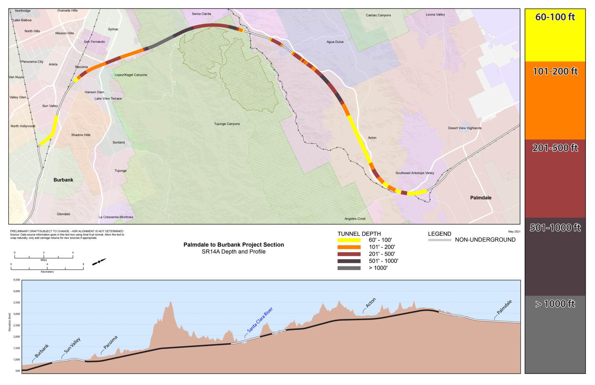
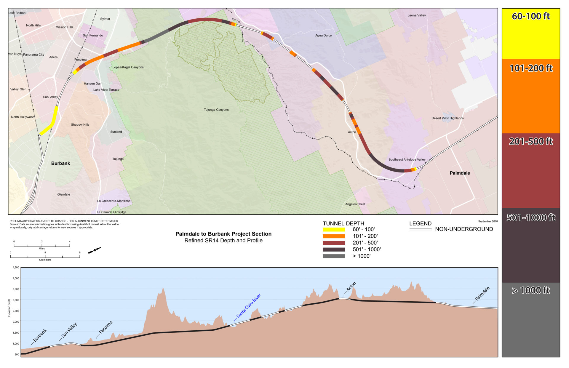
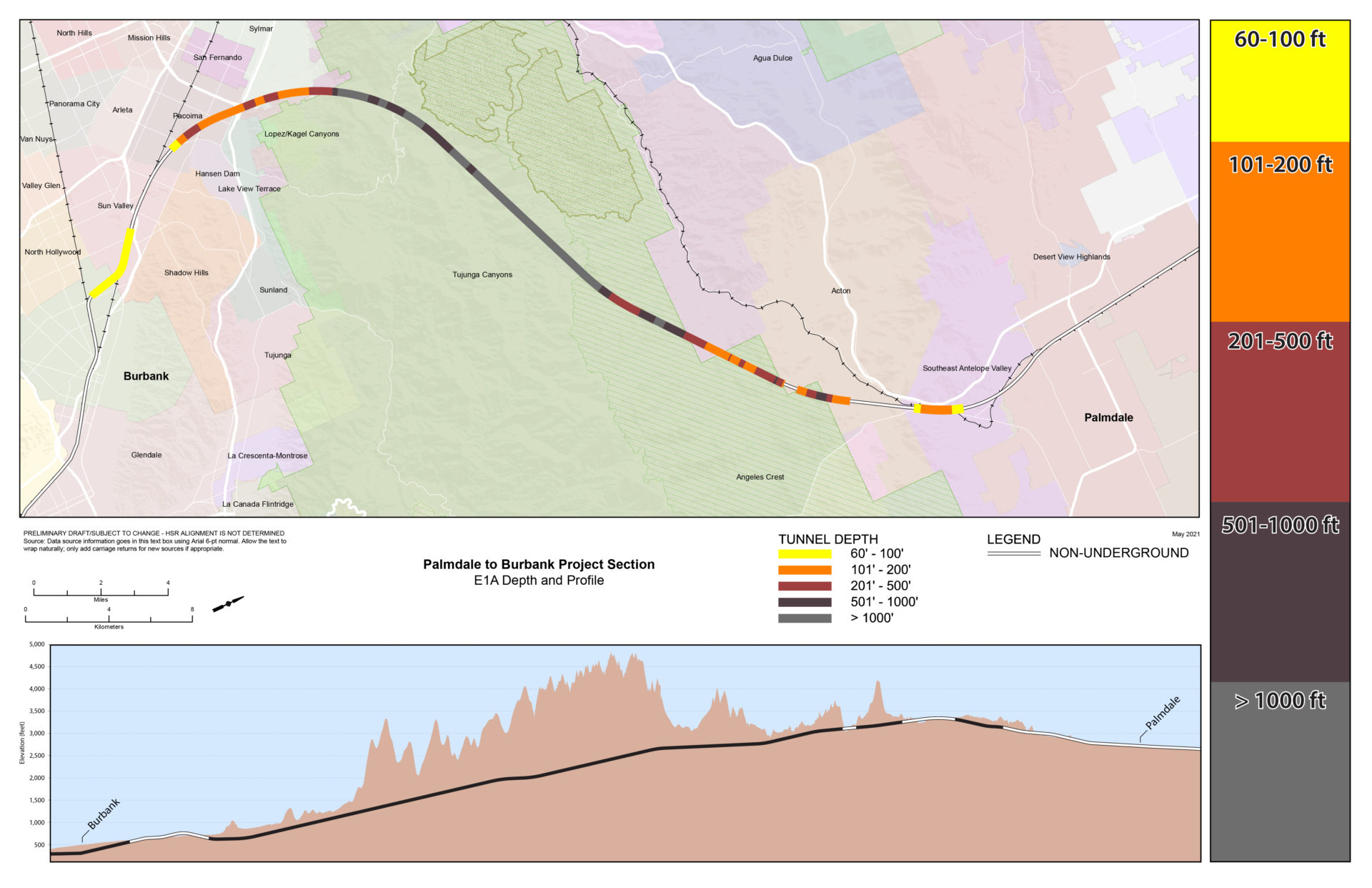
깊이 지도
터널 깊이 지도 SR14A
(선호하는 대안)
터널 깊이 지도 정제된 SR14
터널 깊이 지도 E1A
터널 깊이 지도 E1

터널 깊이 지도 E2A

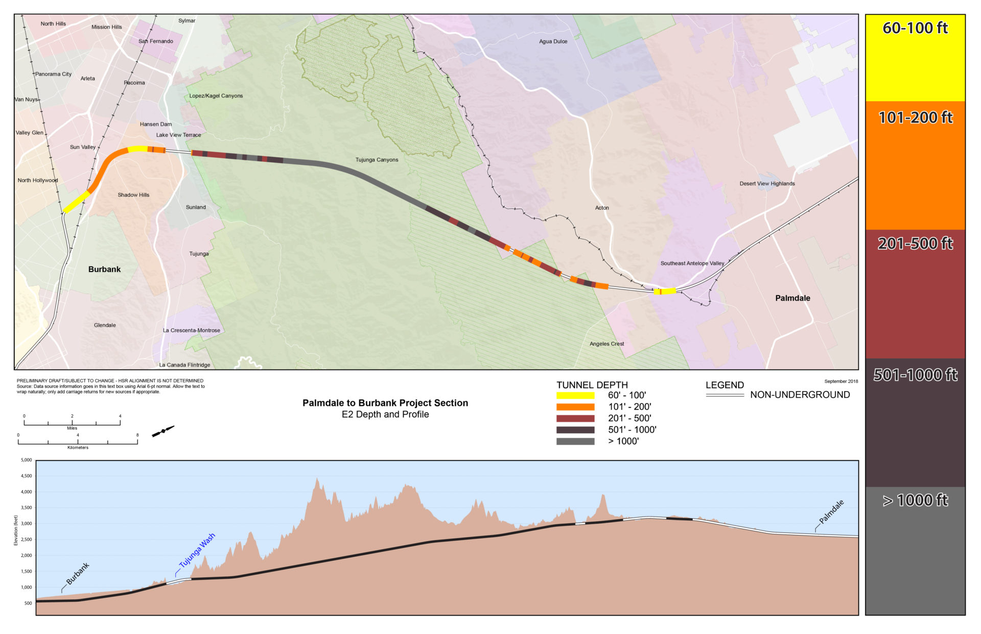
터널 깊이 지도 E2
노선 간 비교
이 표는 다양한 설계 특징과 터널 구간 길이를 포함하여 Palmdale의 Spruce Court에서 Burbank Station까지의 각 대안에 대한 정보를 제공합니다.

포털 예시

